Human Software is set in the fictional town of Sandport. I wanted to imagine a world where great storm of 1287 hadn’t had the same effect on the coastline as it truly did.
In the real world, Sandwich, a previously large and influential port, became effectively landlocked. It’s power robbed.
In Human Software, I imagine a world where the might Wantsum Channel between the Isle of Thanet and the Kent mainland still exists. Bridged by three large, powerful bridges.
To help me generate a fictional map of this alternative reality, I used a few sources. Not least the excellent references on Wikipedia of course.
I also used Google Maps, and the excellent FloodMap that allows you to enter the numbers above (or indeed below) current sea level you want to set your sea level and see the results.
Preparing the Paper
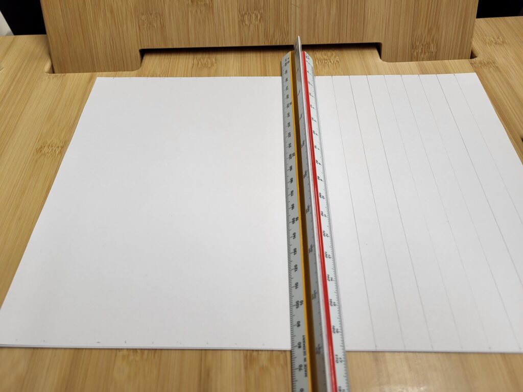
I started out adding a guide grid to a sheet of A4 plain paper. I made the grid slightly non square, a wider gap than higher to stretch the area from the source material. I might eventually make a larger, higher res version of the whole thing but for the moment I want to be able to scan in the final result and I only have an A4 bed scanner.
This is the start of the grid.
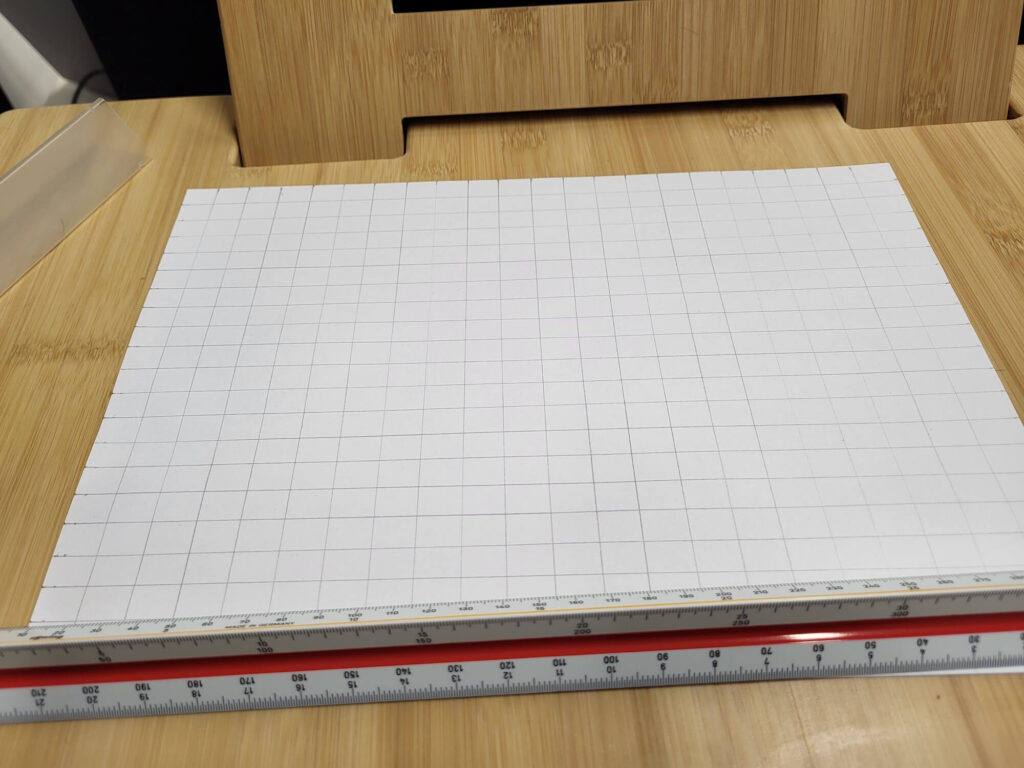
And the completed grid. So now I have a 22 x 21 grid – I mark the numbers on the paper so I can quickly find where I am when transcribing.
Preparing the Source Material
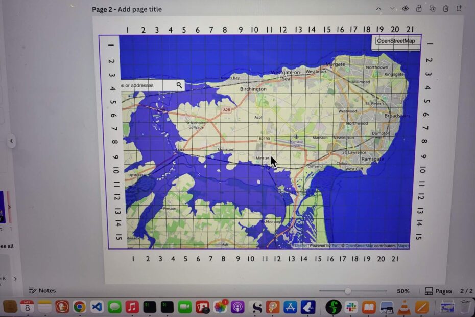
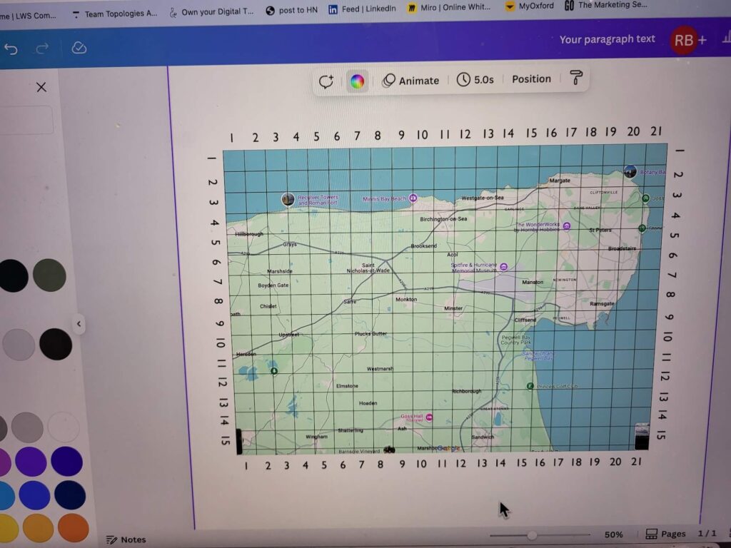
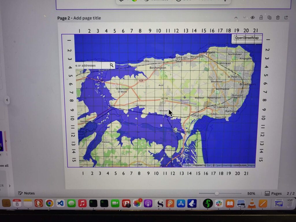
Next, I find the area I want to transcribe and take a snapshot directly from Google Maps. Then I use the Grid Overlay Tool to quickly add a simple grid to the image. Then I download this image and throw it into canva where I can add some numbers and tidy it up a little.
Adding a grid to the google map screen capture.
Adding the sea level rise view. This wasn’t a complete 1:1 match with the scale of the google map screen capture but good enough to give me an idea of where to draw the coastline.
Transcribing
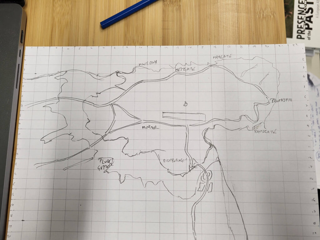
Now we have the source material ready, I can start tracing the coastline one block at a time.

I have the basic shape in place so I include some roads and place names.
Overtracing and Inking
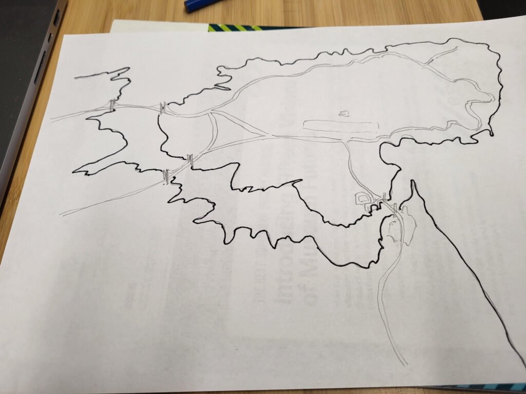
Now I’m ready to make an overtrace of the original transcription and start to ink in some of the details.
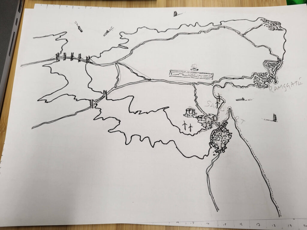
Filling in some more detail. Adding Sandport and Ramsgate and some of Broadstairs. Inking in the bridges.
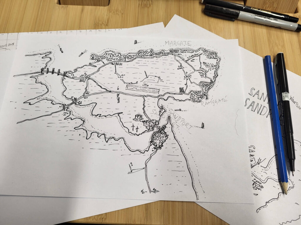
Getting Closer
A couple of shots of the current work in progress.
And another

The next stage for the map is to complete the name plates for the important places on the map – Sandport, Ramsgate, Margate – all of which feature in the story. Then I’ll make a high-resolution scan, and it’ll be ready (in theory) to slot into the front of the book.
The next task for me is to reimagine the cover of the book. It will also be in black and white.